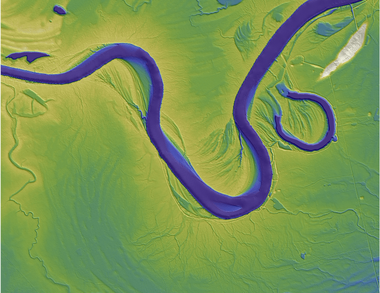
Natural levee formation on the Trinity River, Texas
Natural levees are the elevation boundary between a river and its floodplain. By looking at how sediment is transported (ie. deposited and eroded) on levees, I want to better understand the sediment and organic matter fluxes to floodplains. The further knowledge of the way sediment transport shapes floodplain topography will allow for a more precise quantification of the sediment and organic matter storage. Additionally, this research will look at the impact of flooding on the floodplain, which is important for infrastructure and resources development.
Associated Papers
Hassenruck-Gudipati, H.J., Passalacqua,P., Mohrig, D., (2022). Natural Levees Increase in Prevalence in the Backwater Zone: Coastal Trinity River, Texas, USA Geology. https://doi.org/10.113/G50011.1/.
Tull, N., Passalacqua, P., Hassenruck-Gudipati, H.J., Rahman, S., Wright, K., Hariharan, J., Mohrig, D. (2022). Bidirectional river-floodplain connectivity during combined pluvial-fluvial events. Water Resources Research, 58, e2021WR030492. https://doi.org/10.1029/2021WR030492
Methods
Lidar, Numerical Modeling, USGS gauge data
